Accurate Reality Capture for Construction, Renovation, and BIM Projects

Laser scanning
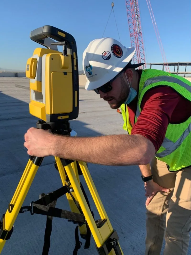
Laser scanning, also known as high definition surveying (HDS), is a highly accurate method of mapping a building and site. The process is performed by measuring the time interval to reflect a laser off a point on the building and return. The laser scanning mechanism does this millions of times from different points around the site to produce precise positional data of virtually all points on the existing structure. This data can then be converted into a visual representation of the environment in BIM software, often called a point cloud.

Drone capture
Drone services for Agriculture, Construction, Inspection, Mining and Quarries, Oil & Gas, Roofing, and Solar needs.
Saving the contractor thousands by verifying sleeves and block-outs prior to concrete pours.
Matterport camera 3d services

Boma measurement and drawings

Building Owners and Managers Association Drawings and measurements per BOMA 2017 standards. We can help you accurately, with laser precision, find your load factors. These floor plans and accurate sure footage calculations help with decision making for leasing, operations, and investments. We offer BOMA drawings in ACAD and PDF format as well as suite 3D virtual walk-throughs.
Point layout
Point Layout is used to bring precision and accuracy to construction field survey and layout workflows leveraging BIM and CAD data. By using Point Layout, contractors can better pinpoint project coordinates and layout measurements, capture as-built conditions, and move data between the field and office to save time, reduce errors, and improve communication.